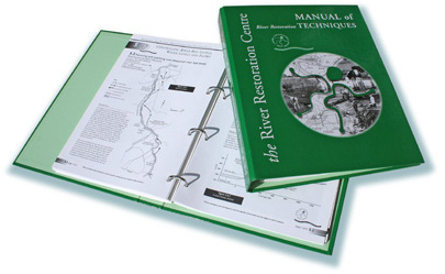

The manual of River Restoration Techniques
is presented
in PDF (Adobe Portable
Document Format),
a FREE viewer
can be downloaded from the Adobe
website, simply click
here

To order a copy
Return to the main Manual page,
where you can download an order form,
Click here
Introduction to the Manual (113k)
![]()
![]() Restoring meanders to straightened rivers
Restoring meanders to straightened rivers
1.1 New meandering channel through open fields (658k)
1.2 New channel meandering either side of existing (893k)
1.3 New meander in an impounded river channel (376k)
1.4 New meanders to one side of existing channel (576k)
1.5 New meandering channel replacing concrete weirs (1.1Mb)
1.6 Opening up a culverted stream (940k)
1.7 Reconnecting remnant meanders (1Mb)
![]() Enhancing redundant river channels
Enhancing redundant river channels
2.1 Creation of backwaters River Skerne (564k)
2.2 Creation of backwaters River Cole (752k)
![]() Enhancing straightened river channels
Enhancing straightened river channels
3.1 Current deflectors (705k)
3.2 Narrowing with aquatic ledges (893k)
3.3 Stone riffle (423k)
3.4 Radical re-design from uniform, straight channel to a sinuous, multi-channel river (846k)
3.5 Narrowing of an over-widened channel using low cost groynes (940k)
3.6 Creating a sinuous low-flow channel in an over-widened channel (1Mb)
3.7 Replacing a concrete drain with a 'natural' channel (940k)
3.8 Creation of on-line bays (611k)
3.9 Introducing gravel to inaccessible reaches (799k)
![]() Revetting and supporting river banks
Revetting and supporting river banks
4.1 Willow spiling (329k)
4.2 Willow mattress revetment (376k)
4.3 Log toe and geotextile revetment with willow slips (423k)
4.4 Plant roll revetment (423k)
4.5 Supporting bank slips and exposed tree roots (705k)
4.6 Hurdle and coir matting and revetments (705k)
4.7 Bank revetment using low steel sheet piling and coir rolls (1.3Mb)
![]() Controlling river bed levels, water levels
and flows
Controlling river bed levels, water levels
and flows
5.1 Bifurcation weir and spillway (799k)
5.2 Drop weir structures (517k)
5.3 Restoring and stabilising over-deepened river bed levels (656k)
5.4 Simulated bedrock outcrops (1.6Mb)
5.5 Raising river bed levels (1Mb)
![]() Managing overland floods
Managing overland floods
6.1 Floodplain spillways (705k)
6.2 Re-profiling of land within meanders (282k)
6.3 Removing and setting back flood banks (752k)
![]() Creating floodplain wetland features
Creating floodplain wetland features
7.1 Floodplain scrapes (376k)
7.2 Floodplain wetland mosaic (2.1Mb)
![]() Providing public, private and livestock
access
Providing public, private and livestock
access
8.1 Fords and stock watering point (752k)
8.2 Watercourse crossings (752k)
8.3 Access paths suitable for disabled users (376k)
8.4 Restoring a ford as a stock and vehicular crossing point (658k)
8.5 Urban riverside access (987k)
![]() Enhancing outfalls to rivers
Enhancing outfalls to rivers
9.1 Surface water outfalls (470k)
9.2 Reedbed at Raglan Stream (611k)
![]() Utilising spoil excavated from rivers
Utilising spoil excavated from rivers
10.1 Landforms at Keepsafe and Rockwell (376k)
10.2 New landforms (329k)
10.3 Cost effective silt removal from impounded channel (940k)
![]() River diversions
River diversions
11.1 Diversion of a river valley (611k)
11.2 Clay lined river (1.5Mb)
![]()